Arroyo Hondo Emergency Evacuation Route
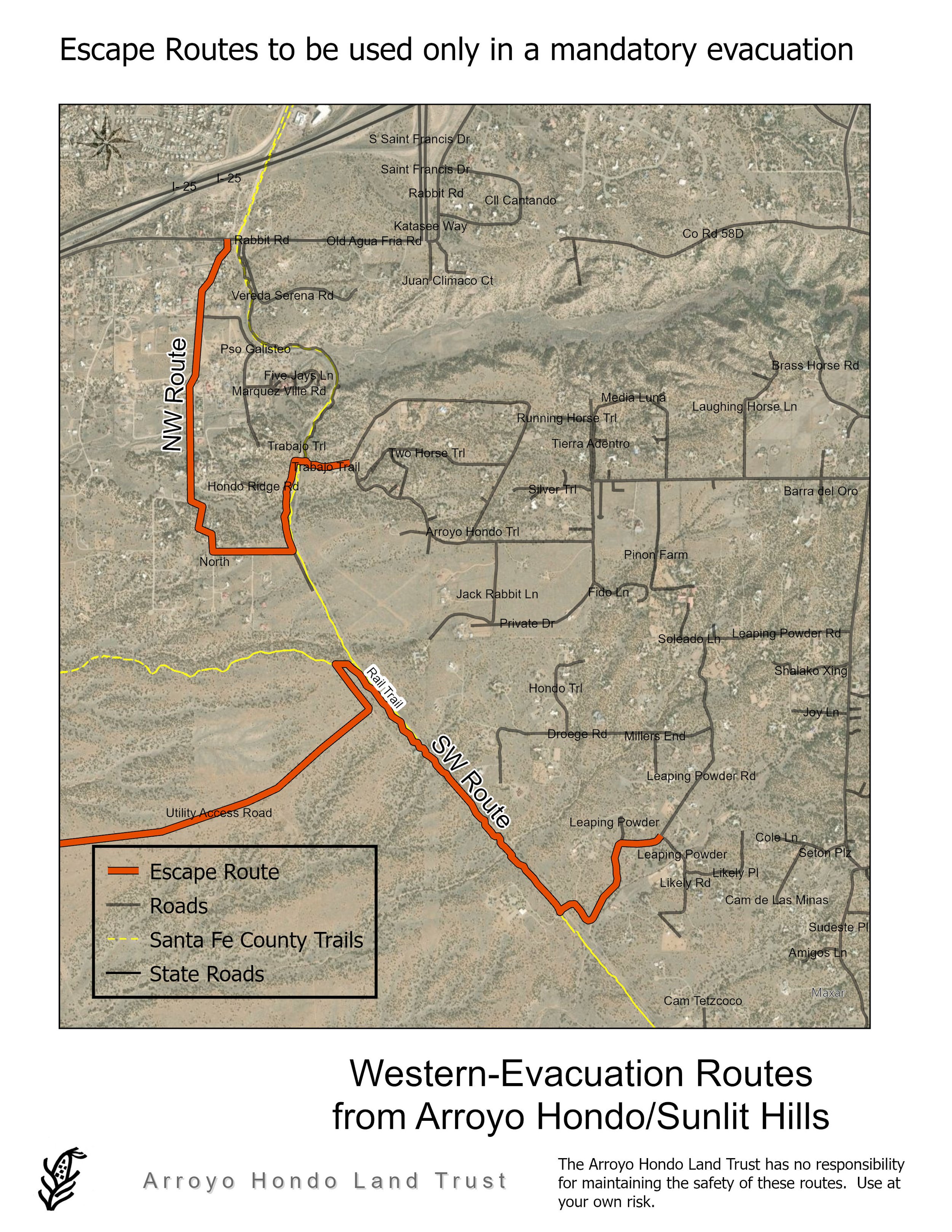
This map shows the location of a western exit from the Arroyo Hondo neighborhood which entails opening a padlocked gate at the end of Trabajo Trail, crossing the railroad tracks and driving on a private access road that exits to the Hondo West neighborhood. It is ONLY to be used in the event of a fire emergency. Coordination with Santa Fe County, NM Department of Transportation, and private land owners is ongoing to improve aspects of this route.
Click here for printable Evacuation Route Map